
Lightning map shows where storm struck in Northampton
Thanks to a dedicated lightning data website, the Chron has put together this map showing where lightning struck during the weekend's thunderstorm.
According to the map, 560 lighting strokes were registered in Northampton and south of the town between Rothersthorpe, Milton Malsor and Hardingstone.
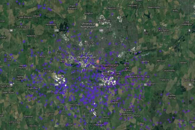

The map was generated by LightningMaps.org, which uses 'lightning event' data supplied by Blitzortung.org.
Each blue marker on the map above shows a registered lightning stroke.
It shows the greatest concentration of strikes was in the area around Hardingstone, Milton Malsor and Brackmills.
Blitzortung is a lightning detection network that locates electromagnetic discharges in the atmosphere using very low frequency radio receivers.
LightningMaps then uses the data to chart where the 'events' have hit.