
Take at look at 15 aerial photos showing the extent of flooding during its peak at the worst affected area in Northampton.
Billing Aquadrome and the surrounding area has been hit hard by the heavy rainfall in the first two days of the New Year.
On New Year’s Day (January 1), residents and holiday makers were told to prepare to ‘evacuate immediately’, with many reportedly taking that advice.
The next day (January 2), the park’s flood sirens sounded and hundreds more fled for safety.
On Wednesday (January 3), the Environment Agency’s flood warning was escalated to “severe” and a “danger to life”. This has now been de-escalated, but there is still a flood alert in place.
Drone pilot David Jackson captured still imagery between Brackmills Industrial Estate and White Mills Marina - including Billing Aquadrome.
The pictures were taken on Wednesday afternoon (January 3) when the flooding is thought to have been at its peak.
A multi-agency rescue operation was deployed yesterday afternoon (Wednesday) to recover the remaining 130 people who ignored warnings to evacuate the park.
Despite the authorities’ efforts, just 31 people, including two children, were rescued by fire crews, leaving an estimated 99 still on site.
Today (Thursday), a weather warning for rain has been issued for Northampton, which could lead to further flooding.
Met Office has issued the yellow warning from midday today until 3am Friday (January 5).
The weather authority says that another spell of rain falling onto saturated ground, “may lead to further flooding and travel disruption”.
Click through our gallery to view the photos.
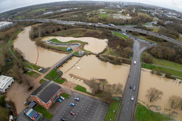
1. Flooding of the River Nene in Northampton
Flooding of the River Nene in Northampton on Wednesday, January 3, 2024. Pictured between Brackmills Industrial Estate and White Mills Marina - including Billing Aquadrome. Photo: David Jackson
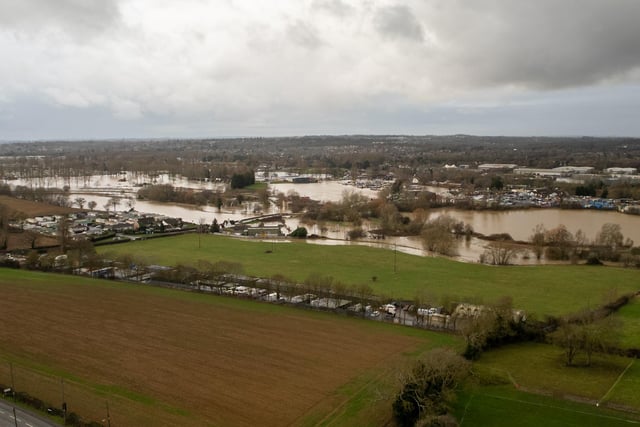
2. Flooding of the River Nene in Northampton
Flooding of the River Nene in Northampton on Wednesday, January 3, 2024. Pictured between Brackmills Industrial Estate and White Mills Marina - including Billing Aquadrome. Photo: David Jackson
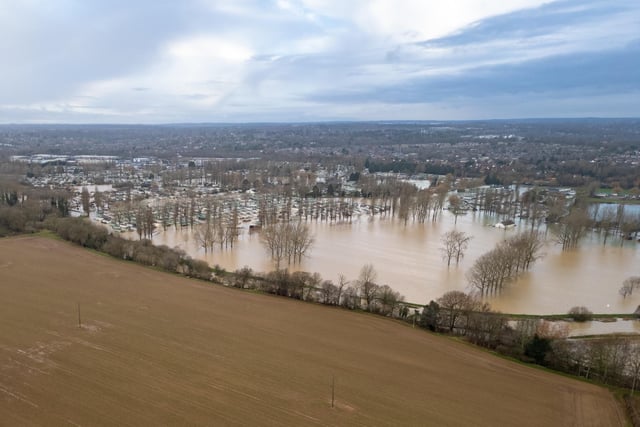
3. Flooding at Billing Aquadrome
Here's what the site looked like on Wednesday afternoon (January 3), when the flooding was at its peak Photo: David Jackson
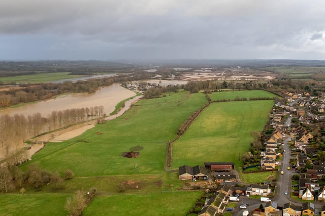
4. Flooding of the River Nene in Northampton
Flooding of the River Nene in Northampton on Wednesday, January 3, 2024. Pictured between Brackmills Industrial Estate and White Mills Marina - including Billing Aquadrome. Photo: David Jackson