Campaign group has high hopes for new survey mapping out Northampton Castle


Mapping experts have been commissioned by Northampton Borough Council to get a better idea of exactly where different parts of the castle were on the site.
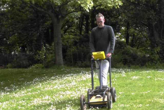
An area presumed to encompass the north gate and part of the northern barbican was surveyed by technicians from the Museum of London Archaeology (MOLA) at the beginning of the week.
Advertisement
Hide AdAdvertisement
Hide AdThe results of an earth resistance survey and ground-penetrating radar will be used to map the layout of the original structure in a zone where medieval foundations were unearthed during excavations in the 1960s and 1970s.
Cabinet member for regeneration, enterprise and planning at Northampton Borough Council, Councillor Tim Hadland, said: “The castle edifice was lost years ago, but the events that took place there will always be an important part of our history so it’s wonderful to have a chance to explore that heritage further.
“The results of the survey should provide us with a rough map of what may still lie beneath the surface. This will be very valuable for interpreting the layout of the castle for future generations."
The Friends of Northampton Castle are working alongside Northampton Borough Council as part of the castle project.
Advertisement
Hide AdAdvertisement
Hide AdDr Marie Dickie OBE, chair of the Friends of Northampton Castle, said: “We know from previous excavations that the survey area includes the most historically significant sections of the castle where the important events would have occurred. It’s possible that the spot we’re looking at this week could be the one where Thomas Becket was tried before he fled to France.
“We hope that following the survey we’ll at least be able to mark out the bare outline of the castle’s footprint, but we’d also like to do some interpretation work to visualise what once was.”