Elderly woman's house insurance triples overnight due to new flood-risk map affecting thousands in Northampton


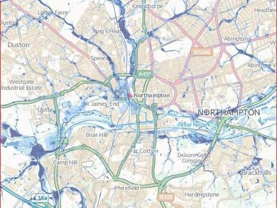
The 'Risk of Flooding from Surface Water' map was compiled up to six years ago but has recently been released, the Environment Agency says, so homeowners can take action but also for insurance companies' perusal.
One victim of the data release is the aunt of former teacher Pas Renda, who lives in Spinney Hill Road and has seen her insurance with Home Policy rise from £136 on Saturday to £450 on Sunday. Neighbours in her postcode area are also likely to be affected in a similar way.
Advertisement
Hide AdAdvertisement
Hide AdMr Renda said: "I phoned the insurance company twice to check and the girl specifically said this flooding map was the reason for the increase.
"It is utterly unscientific, based on a computer modelling system that's imprecise to say the least.
"It's not very nice to think of OAPs sitting at home and paying whatever is asked of them because of this."
Despite the age of the data, and the fact that in many cases it cannot be applied to individual houses, about 40 insurance companies are thought to be using the map.
Advertisement
Hide AdAdvertisement
Hide AdThe Spinney Hill Road postcode is in a High Risk area that the Environment Agency says has greater than 3.3 per cent chance of flooding each year. As opposed to river flooding, surface water flooding can happen hundreds of feet above sea or river level when rainwater has nowhere to go.
The Environment Agency insists it does not believe insurers will exclusively use the new maps to set premiums.
It said: "We make our flood risk information available to insurers who may use it alongside other information to inform their decisions about provision and cost of insurance.
"These decisions are commercially confidential, but it is worth noting that insurers have other information and their own surface water data, so this is an additional dataset, which they may decide to license.
Advertisement
Hide AdAdvertisement
Hide AdIt added: "Neither the county council nor the Environment Agency has any role in determining insurance cover or setting premiums."
To see the Environment Agency's surface water flood-risk for your street, click here.